
City of Chelsea | City-Wide Mobile LiDAR
Chelsea, Massachusetts
The City of Chelsea, having long relied upon a traditional combined wastewater and stormwater drainage system, experienced frequent runoff overflows into neighboring waterways. As a result of the water pollution, residents and officials were increasingly worried about habitat loss and human health risks. The City needed a timely and cost-effective solution in their city-wide effort to separate its sewer and stormwater systems, and additionally sought to update its GIS database.
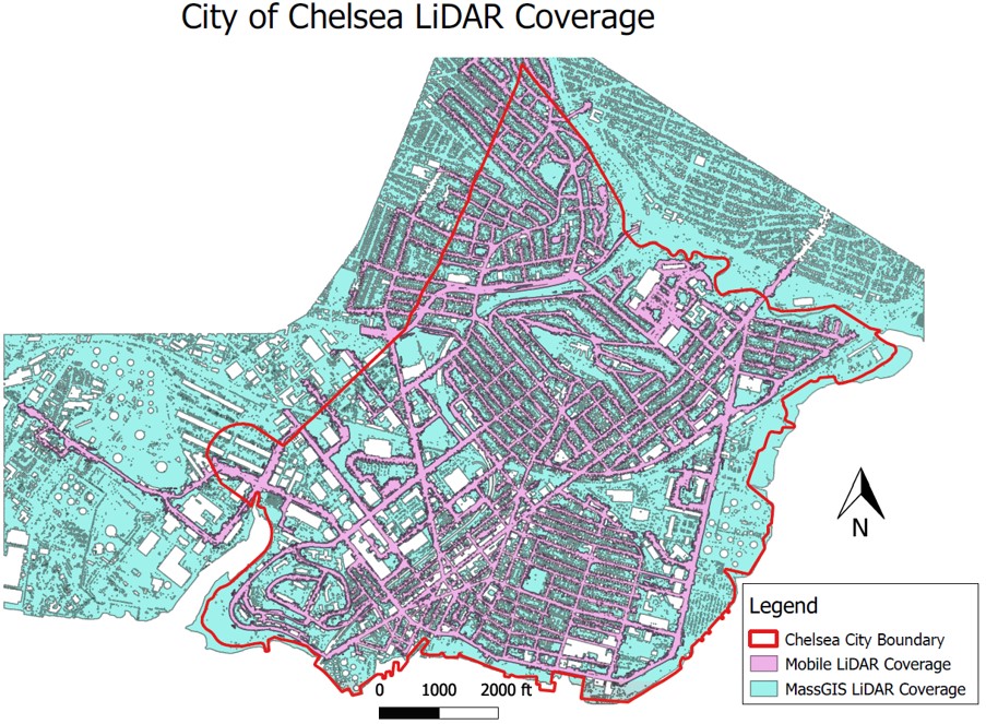
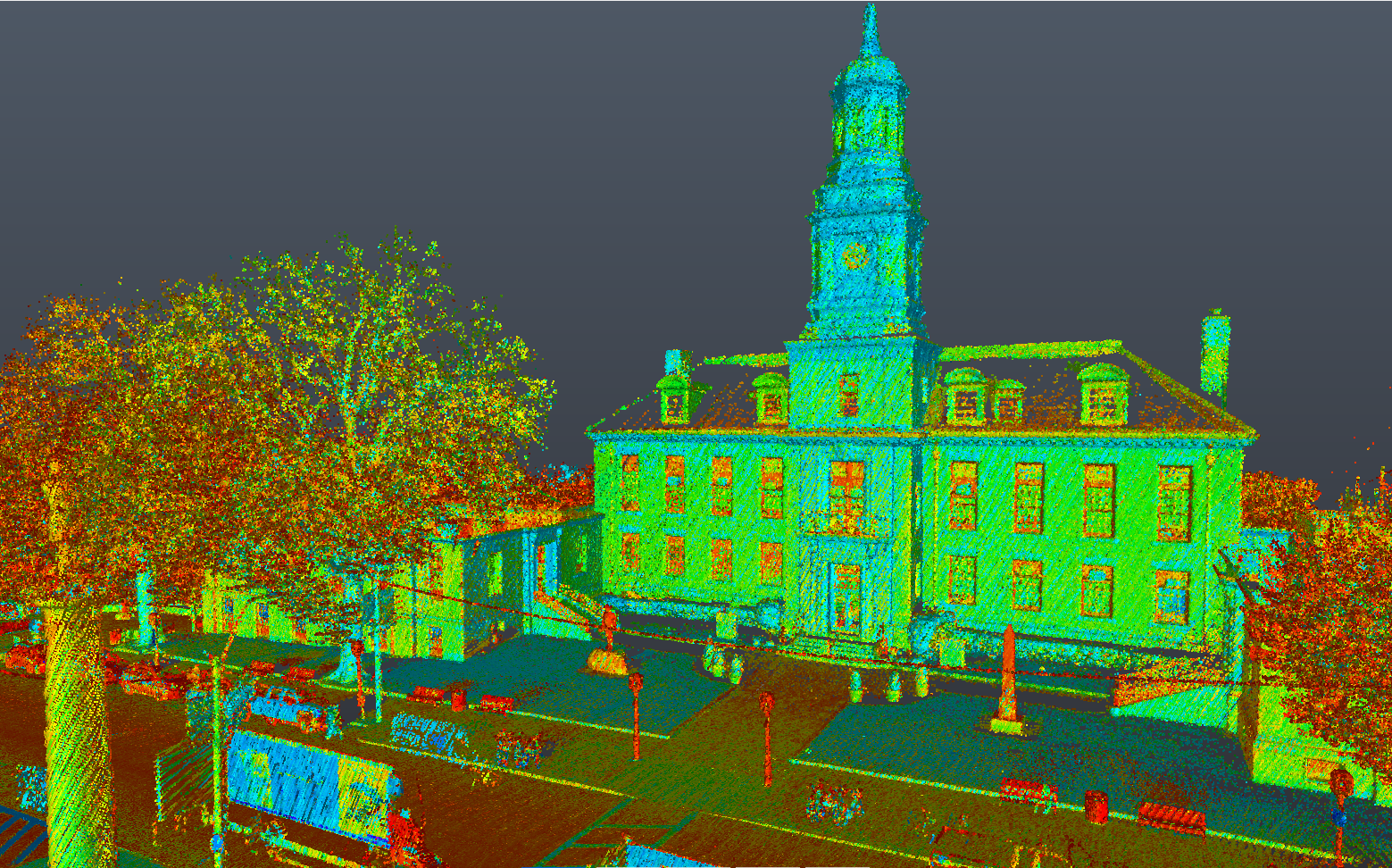
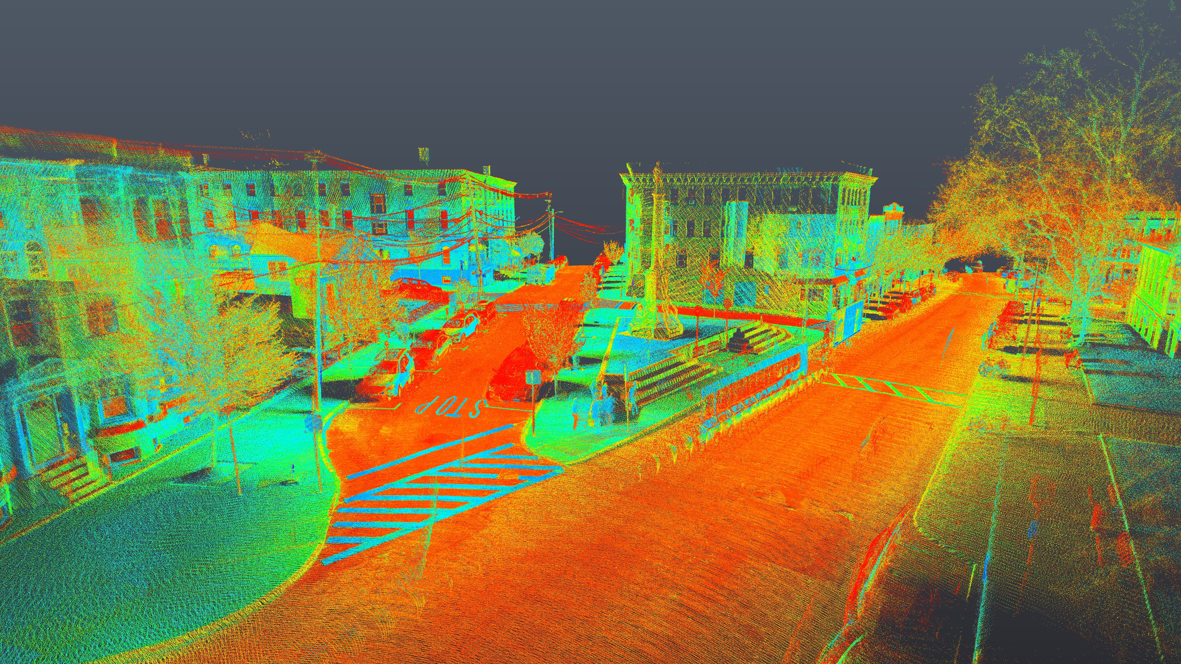
Meridian deployed a mobile LiDAR mapping vehicle along all 44 miles of public roadways in the City to collect billions of laser measurements and tens of thousands of high-resolution images. The resulting comprehensive point cloud database was used to create a seamless Digital Elevation Model (DEM) for modeling and designing the staged replacement of the City’s sewer system. Furthermore, the survey-grade data has served as an informational database for the City to utilize for asset management and future design and construction drawings for infrastructure improvement projects.
Chelsea has seen dividends, in the form of cost savings and expedited project timelines, from the forward-looking dataset. For instance, Meridian was able to immediately leverage the existing LiDAR data to extract features for two separate two and a half linear mile existing conditions surveys.
1
2
3